


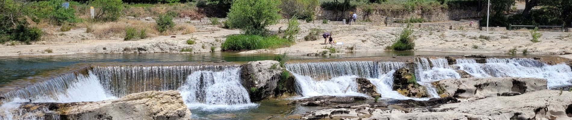
les cascades du Sautadet

amiral13
User GUIDE
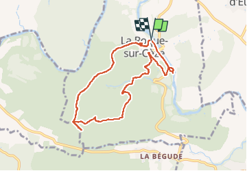

Length
8.6 km

Max alt
245 m

Uphill gradient
279 m
Km-Effort
12.3 km

Min alt
56 m

Downhill gradient
279 m
Boucle
Yes
Creation date :
2022-05-28 09:55:44.521
Updated on :
2022-05-28 15:31:34.538
2h39
Difficulty : Easy

FREE GPS app for hiking
 SityTrail
IGN / Geographical institutes
SityTrail Plus
The world is yours!
About
Trail Walking of 8.6 km to be discovered at Occitania, Gard, La Roque-sur-Cèze. This trail is proposed by amiral13.
Photos


Positioning
Country:
France
Region :
Occitania
Department/Province :
Gard
Municipality :
La Roque-sur-Cèze
Location:
Unknown
Start:(Dec)
Start:(UTM)
621559 ; 4894647 (31T) N.
Comments